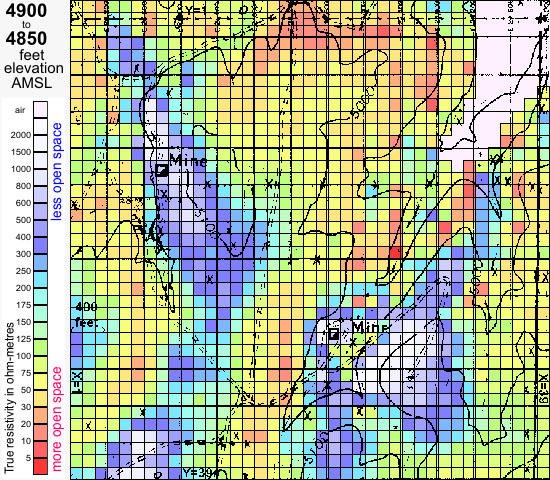

Three lessons are clear from the many 3D E-SCAN projects on volcanic-hosted epithermal gold properties in Nevada:
1. Any prospective covered terrain, even those apparently "saturation drilled", is probably still effectively unexplored.
2. The most-likely subsurface exploration signature for this setting is a resistive anomaly, related to silicification.
3. There is only one geophysical mapping tool that can be relied upon for imaging buried resistive targets,- 3D E-SCAN.
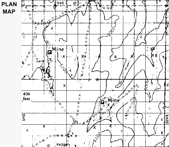
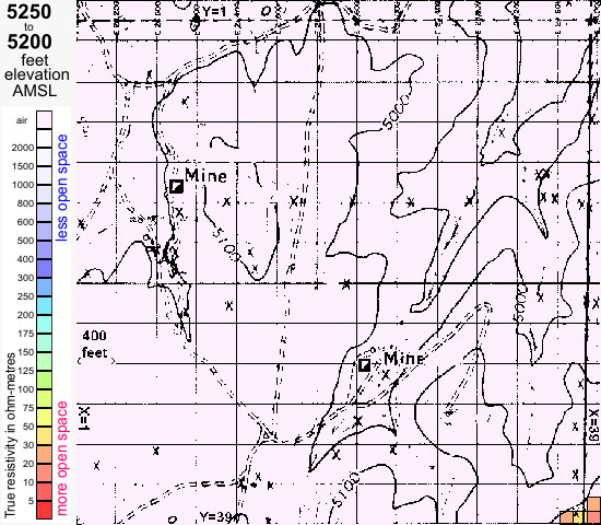
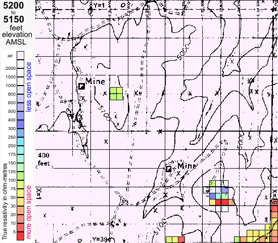
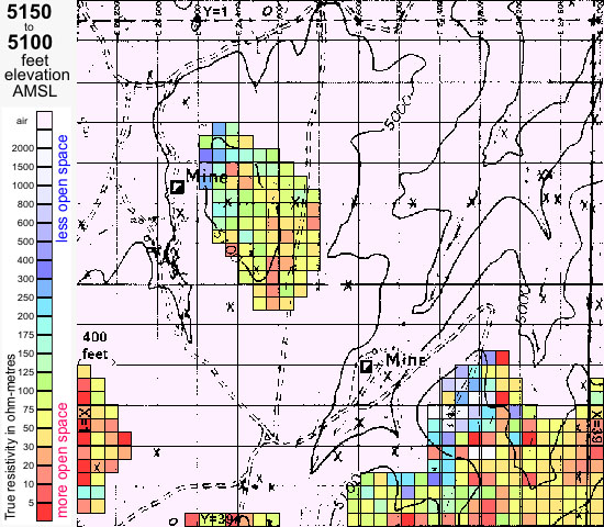
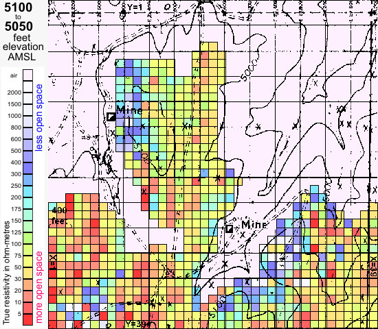
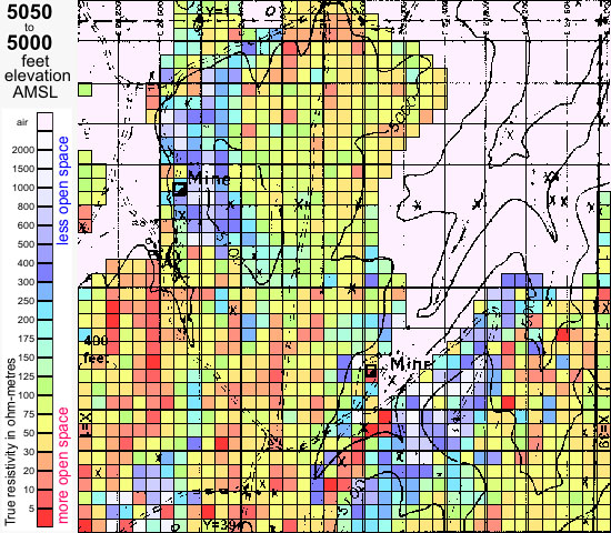
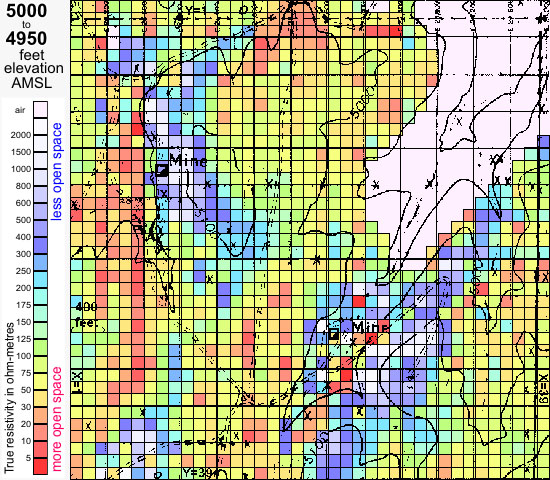
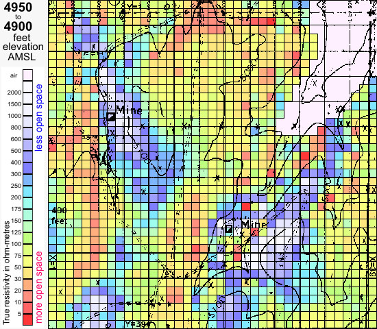
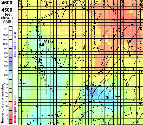
The property at left is a cover play in volcanics of appropriate age and type, located along a mineralized trend, and in this case hosting some obvious focus: two former mercury producers. And now you have some idea of specific resistive features, zoning centers and edges, and trend orientations (structure?) to investigate.
There are hundreds of such settings across Nevada, and with a handful of exceptions like this one, none of them has ever been effectively imaged or mapped below surface.
Strategy is always simple:
- Drop a 3D E-SCAN system over the entire square mile.
- Collect 8 or 10 thousand true 3D field data, clean up site, and depart, usually within a week for a property of this size.
- Process the objective true 3D earth resistivity model and investigate whatever patterns appear.
As an exploration geologist, you have already formed several quick notions of what might need to be investigated here.
As soon as you discover that the "hockey stick" is an intrusive, you'll approach it differently from the blocky pipe to the east, which could be silicified.