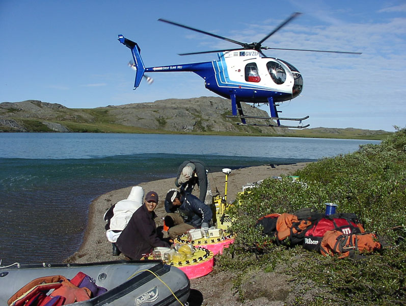
Archean terrain "North of 60"
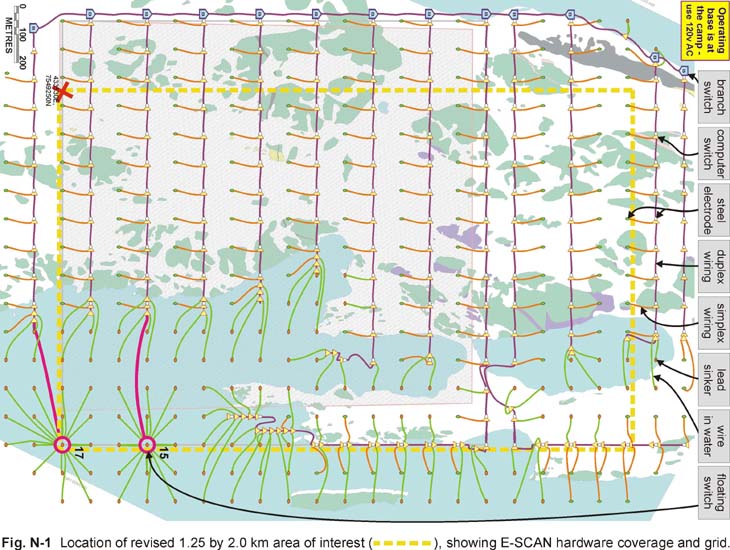
At right is the actual field wiring diagram for a
3D E-SCAN survey north of the Arctic Circle, where lakes occupy a large portion of the study area. Many individual grid stations were installed from the GPS-equipped inflatable boat, by pulling a wire from shore to the grid position where an attached heavy metal fishing weight was lowered to lake bottom to serve as an electrode contact.
In the wider area of the lake, two floating hubs provided access to a total of 32 lake-bottom electrodes sites. Each hub employed a master duplex signal wire connected to the main grid wiring network on shore, and a separate current feeder wire.  The extremely fast shooting of these 32 mid-lake stations made up most of the extra time required to position and install the floating base's lake-bottom electrodes by boat.
On this project, the client's exploration schedule could not accommodate a winter through-ice E-SCAN survey. The water-grid installation maintained perfect continuity in the true 3D field data set (uniform distribution, high density, and multi-directional data set characteristics), as if the lake wasn't there.
Time, cost, risk?
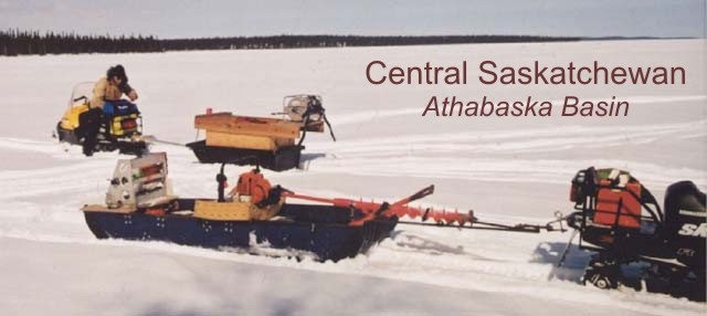
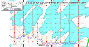
Central Saskatchewan
"Athabaska Basin"
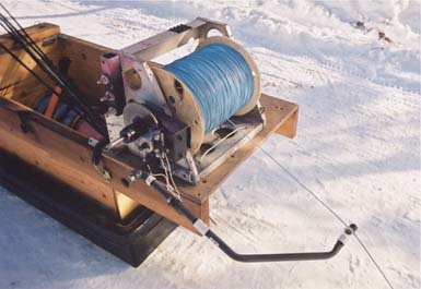
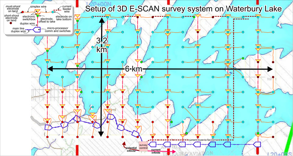
Above is the field wiring diagram for a 3D E-SCAN survey to test resolution of unconformity uranium target features, in an area dominated by Waterbury Lake. Year-round road-accessible infrastructure at the nearby Cigar Lake mine helped to make this an easy "in winter" choice for survey timing. Snowmobiles easily traversed the lake with GPS guidance, to install and wire the electrode stations on the 400 metre spaced survey grid. High-speed wire deployment from disc-braked , damped spoolers made laying out the wire a simple task, and gas-powered re-winders made recovery and cleanup go fast. A powered auger easily drilled through the 1 metre thick ice, allowing electrodes to be lowered into the lake-bottom mud, at each station.
The lake installation maintained perfect continuity in the true 3D field data set (uniform distribution, high density, and multi-directional data set characteristics), as if the lake wasn't there.
Time, cost, risk?

Northern Canada"Diamonds"
At right is an example of how 3D E-SCAN would wire a depression (a pond or small lake) suspected of being the site of a buried kimberlite pipe.
In winter, the frozen surface would allow on-ice wiring and through-ice, pond-bottom electrode installation.
Time, cost, risk?
Nor is winter a more favorable time to be operating here, with expectations of 2 to 3 metre thick lake ice and routine temperatures below -40 degrees, this far north of the Arctic Circle.
3D E-SCAN has not yet been deployed on this type of survey.
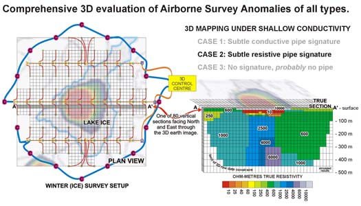
This is a plan for a high-speed, several-per-week helicopter-
supported program for the comprehensive evaluation of 10 to
200 AeroMagnetics or Airborne EM anomalies.
Time: Several sites per week with a crack crew.
Cost: To be determined.
Risk to client: Probably a per-day, best-efforts operation.
Fixed pricing could also be calculated, helicopter at cost.
This project was planned as a partly-lake survey, well in advance.
Time: Faster than a summer open-water survey; as fast as
the best open-terrain ATV project.
Cost: No extra charges.
Risk to client: None. Fixed price guaranteed, including mine camp room and board.
This project was obviously planned as a partly-lake survey, well in advance.
Time: Between no ATV's (all on foot, helicopter setouts) and
large water areas, twice the time needed.
Cost: About 50% premium for conditions.
Risk to client: Minimal. Helicopters already in the area for drilling.
Fixed price guaranteed, but camp and helicopter at client expense.