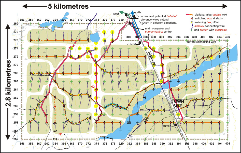
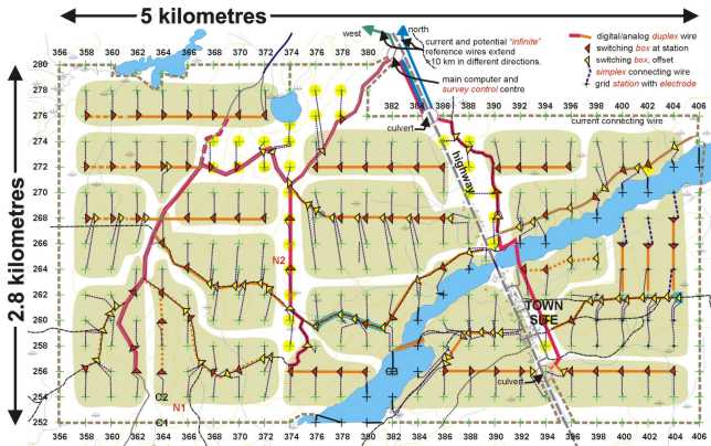
A combination of paved roads and farm tracks are key to the fast and effective wiring of this property. Main duplex (two-conductor) lines are laid along the roads from ATV's, with other electrode sites placed on either side.
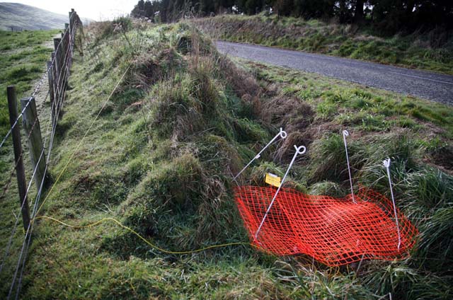
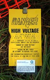
Here, a nest of four steel electrodes being used as an "infinite" reference station is covered by plastic netting to keep stray animals from disturbing the wiring. The setup will be there for the duration of the survey, usually 10 to 14 days. Clip-on signage located at intervals all along the wire advises of the "geophysical survey in progress" and warns against touching or moving the wire.
In this Archean exploration setting in northwest Quebec, no road crossings were permitted (or desirable!) on the road surface. Trees were tall enough, but set back too far. The entire survey area on the east (right) side of the highway was wired and surveyed using two steel culverts under the road, and a more central access point at the river, under the bridge. Using these feed-through points had little effect on the cost of installation and shooting of the survey, and zero effect on the completeness and patterns of the measured data set.
The results are as if the highway impediment
did not exist.
Rural roads are ideal as main wire routes, with branched traverse lines extending out across the landscape. Trees can be used to suspend wire in the air, to access the other side of the road. The roads speed access for troubleshooting as well. Offsetting this convenience is increased responsibility to protect the wires from vandalism, and to protect the public.
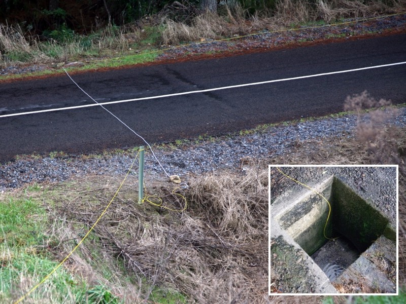
Where no suitable trees are available for passing wire high across to the other side, moderate-traffic roads can be crossed on surface by using a heavy-insulation section of wire tied off on both sides of the road. Where traffic is heavy, or where a wire will remain in use for perhaps two straight weeks rather than just a few days, any convenient under-road culvert or drainage pipe can be used to pass the wire through in a protected environment.
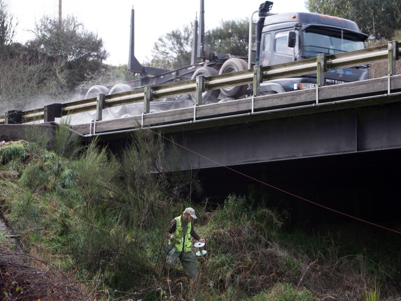
Major highways often have restrictions regarding laying wire along the verges, and usually forbid laying wire across the surface of the road. Trees may be too far back from the road to support overhead crossings. Fortunately, most major roads have well-planned drainage management, meaning that drainage culverts may be available within a kilometre in either direction of a preferred crossing location. Once laid through a culvert, a single set of wires can service the entire half of the 3D E-SCAN survey grid located on the other side of the road, without needing additional crossing sites. Of course, a bridge makes a good crossing site.