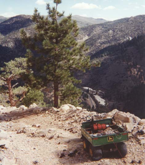
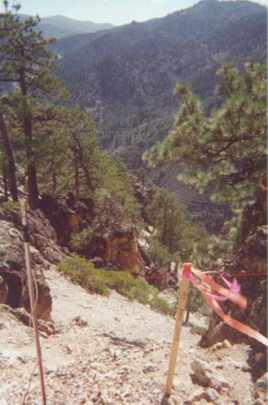
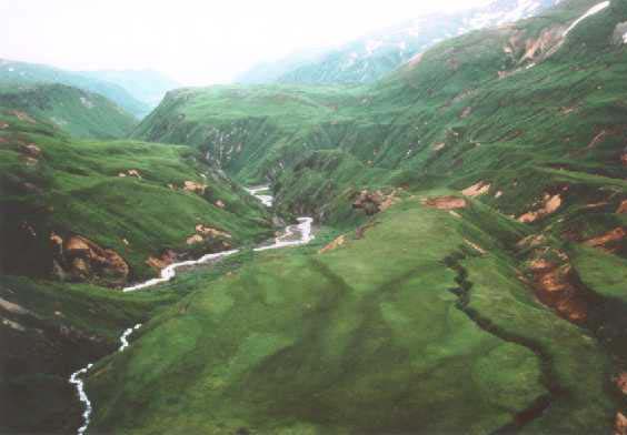
 Left, an intrusive gold property, Sierra Nevada, south of
Lake Tahoe. Using of old drill roads, a five-wheel ATV
was used to distribute stockpiles of wire and electrodes at several high points across the square-mile property.
Crew then installed the E-SCAN system, laying wire and installing electrodes down the steep slopes, each excursion
ending with an ATV-ride back to the top for the next run.
Time, cost, risk?
Left, an intrusive gold property, Sierra Nevada, south of
Lake Tahoe. Using of old drill roads, a five-wheel ATV
was used to distribute stockpiles of wire and electrodes at several high points across the square-mile property.
Crew then installed the E-SCAN system, laying wire and installing electrodes down the steep slopes, each excursion
ending with an ATV-ride back to the top for the next run.
Time, cost, risk?
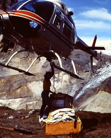
 Above is some of the core area of a 3D E-SCAN geothermal survey on Mt. Makushin, Unalaska Island,
the Aleutians, for Alaska Power Authority.
Oversteepened, dissected, unstable ashfall slopes predominate, the wet grass offering no
handholds to arrest a fall toward the dangerous
white water that fills most gullies.
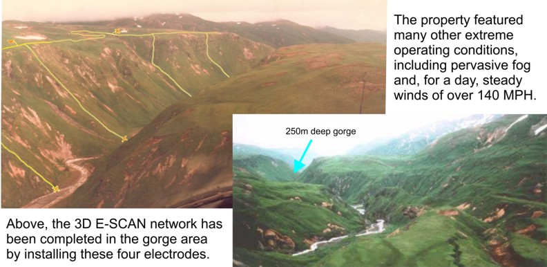
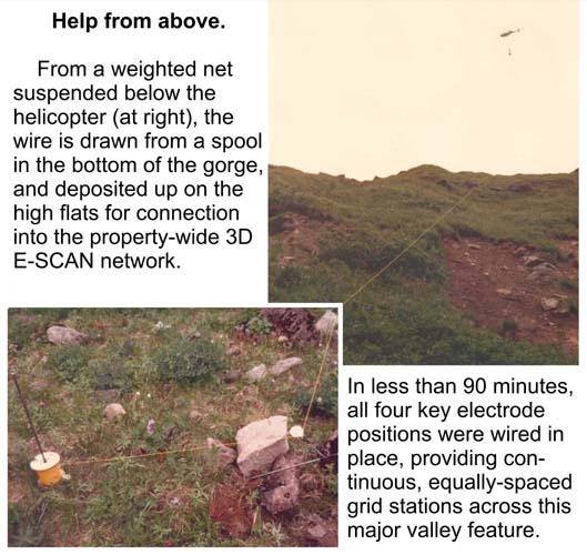
The canyon in the distance (upper left) is 250 metres deep,
needing helicopter wiring assistance. Time, cost, risk?
Above is some of the core area of a 3D E-SCAN geothermal survey on Mt. Makushin, Unalaska Island,
the Aleutians, for Alaska Power Authority.
Oversteepened, dissected, unstable ashfall slopes predominate, the wet grass offering no
handholds to arrest a fall toward the dangerous
white water that fills most gullies.
The canyon in the distance (upper left) is 250 metres deep,
needing helicopter wiring assistance. Time, cost, risk?
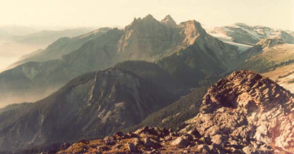
The first 3D E-SCAN survey, for the Geological Survey of Canada was on the Mt. Cayley property of BC Hydro and Power Authority.
The view is looking north across Mt. Cayley. The Squamish River valley is in fog to the left. The survey's targeted area extends
from behind the viewer, to include the steep airfall ash ridge that extends up to the main edifice, and everything past the right edge of the photo.
Two years prior, best-efforts dipole-dipole array resistivity traverses through the area had identified a conductive anomaly system
which offered 11 plausible anomaly interpretations. E-SCAN true 3D results cleared up the c
onfusion, firmly rejecting 10 of the candidates. In some rough terrain, the crew, camp, groceries, equipment, wire,- everything comes in and
goes out by helicopter. Time, cost, risk?
The entire 15 square mile Makushin property was wired, shot in
full 3D E-SCAN, and then cleaned up, in 24 days by a crew of six.
The project was cost-estimated from maps in San Francisco, and a
fixed price bound into the survey contract. Camp and helicopter
costs were separate, being already established to support a drill
crew. Both time and cost estimates were met, despite the remote
site, extreme terrain conditions and unpredictable, wild weather.
The client remained risk-free and fully protected, except for the
possibility of helicopter cost overruns, which did not occur.
Time: doubled
Cost: 50% premium over flat land
Risks to client: helicopter cost overrun, and extreme
weather force majeure. Neither occurred.
The Zaca property was wired, shot in full 3D E-SCAN, and
then cleaned up, in 10 days by a highly-skilled crew, on
a guaranteed-in-advance fixed budget. As predicted, this
steep square-mile took twice as long to survey as similar
size projects that have been done in open, ATV-amenable
sagebrush pediment. By contract, the client was fully
protected from any cost overrun exposure.
Time: doubled
Cost: 50% premium over flat land
Risk to client: none.
No helicopter, no camp costs (motel).
Even in this first-ever 3D E-SCAN survey, costs were estimated
in advance and the field contract completed on a guaranteed cost
basis. The GSC and BC Hydro remained risk-free and fully protected
from cost overruns. Helicopter use (client expense) was less than
planned for. Camp was provided by Premier as part of the fixed
cost contract.
Time: doubled
Cost: 50% premium over flat land
Risk to client: helicopter cost overrun (did not occur).